
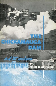
The Chickamauga Dam and its environs — Reading Companion

(5 User reviews)   717
In Category - Civil Engineering
Walker, Robert Sparks, 1878-1960 Project Gutenberg 2023
Chickamauga Dam (Tenn.); Tennessee River Valley; Chattanooga (Tenn.) -- History Readers of public-domain and historical texts
Project Gutenberg digital edition en

Edition facts

Words: 12,050
Reading time: 53 min
Text sections: 4
Robert Sparks Walker's 1949 guide blends on-site engineering description of Chickamauga Dam with Cherokee history, including Ostenaco's 1762 London visit and the Brainerd Mission school, revealing a layered regional narrative.
Share
Editorial Edition Score 4.5/5

Calculated from edition completeness, EPUB availability, text structure and catalogue metadata. Not a user rating.

Edition quality

Read the Text

uke was so bitterly hated that the early Scotch settlers in America refused to call the mountains by the name _Cumberland_, preferring to speak of them by their Cherokee name _Ouisoto Mountains_, (pronounced We-soto).

If we could leap like a giant kangaroo, the first kick of our hind legs down the Tennessee River would leave us standing on the dam at Hales Bar, forty miles from here. Another leap of eighty-two miles and we would rest on Guntersville Dam in Alabama. Our third leap would take us seventy-four miles farther on where we would strike the Wheeler Dam. Next a kitten’s spring of only sixteen miles and we would strike the Wilson Dam. A sudden jump of 52 miles would leave us astride the Pickwick Dam, and then a tremendous long leap of 184 miles and we would find ourselves perched on the Kentucky Dam, only twenty-three miles from the mouth of the Tennessee River at Paducah, Kentucky. If we chose to continue the journey to the mouth of the river we would find ourselves 471 miles from where we now stand on the Chickamauga Dam.

The high railroad bridge we see directly in front of us is where the Cincinnati-Chattanooga division of the Southern Railway crosses the river. This railroad is owned by the city of Cincinnati and leased by the Southern Railway. The creek a few rods to our right is the North Chickamauga. It has its source on Waldens Ridge and leaves the mountain about fifteen miles from here at Daisy, Tennessee, where it has chiseled out a marvelously beautiful gulch of rustic beauty. When the Chickamauga Dam was begun, this creek emptied into the river a short distance above the dam, but after an artificial bed was dug, its course was changed so that it would find the river below the dam.

To our left, on the south side, we can see where the South Chickamauga Creek empties into the Tennessee. It was there that the Federal troops under General W. T. Sherman crossed on pontoon bridges at daylight, November 24, 1863. The steamer _Dunbar_ assisted in transporting Sherman’s division to the other side of the river. A pontoon was also laid across the mouth of the Chickamauga. It was then that Sherman attacked the right wing of General Bragg’s Confederate forces, which occupied Missionary Ridge from this north end to the south. Sherman was fighting throughout the day while the battle of Lookout Mountain was raging to our southwest. Because Missionary Ridge ends near the Chickamauga Dam, and since the battle fought there on November 25, 1863, has been regarded by some historians as the turning point in the Civil War, a little later I shall describe briefly that battle. For the present we shall leave some of the interesting places below the dam in order to tell about a few sites and historical events that took place above the dam and along the South Chickamauga Creek.

DALLAS AND DALLAS ISLAND

The waters that gather above the Chickamauga Dam have quite naturally obliterated some old village sites and some prehistoric mounds. It was fortunate, however, that the Department of Archaeology, under the direction of T. M. N. Lewis, of the University of Tennessee, made scientific explorations of the ancient dwelling places and the mounds. The facts and the artifacts thus obtained have been preserved for posterity.

On February 26, 1940, when the navigation lock at the Chickamauga Dam was opened, since there was no Cherokee Indian to represent the aborigines who used the Tennessee to make the initial trip through it, it was a fortunate circumstance that Nature stepped in and saved the day on that memorable occasion and let a large turtle swim through. It was a splendid model for a river boat, somewhat made on the order of a submarine, a natural boat propelled by living paddles and guided by a live rudder. It passed through the lock as freely as if it had been commissioned to serve as the official representative of the river’s inhabitants.

Among the historical places blotted out by waters of Chickamauga Dam was Oo-le-quah, or Dallas Island, situated a few miles upstream. On the higher ground overlooking the isle was the village of Dallas, which, in 1819, became the seat of government at the time Hamilton County, in which the Chickamauga Dam is situated, was carved out of the Hiwassee Purchase. The new county’s south boundary at that date was the Tennessee River, which up to about the year 1800, had been known to the Indians as the Hogohegee River. The Cherokees still remained in possession of the land south of the river.

When the state of Georgia, by force, took possession of the Cherokee lands within her borders, some of the prominent Indians sought refuge in Tennessee. Among those who were chased out of Georgia was Joseph Vann of Spring Place, a dozen miles east of Dalton. James Vann, the father of Joseph, had married a full-blooded Cherokee. He was a prosperous farmer. The two and a half-story brick residence he erected about the year 1797 still stands at Spring Place and has been tenanted through the years. It is looked on today as a splendid example of early architecture.

After leaving Georgia, Joseph Vann settled on the south bank of the Tennessee River, a few miles above the Chickamauga Dam. He was very industrious, and soon there were thirty-five houses erected and occupied on his property. The village was known as Vanntown. There was scarcely a moment’s rest, however, for the poor Indians. The greedy whites kept encroaching on their real estate until only a small portion of their once large territory remained. Several years previously the government had induced some of the Cherokees to move to the Arkansas, west of the Mississippi. The last of the Cherokees departed in 1838. At that time the white settlers took possession of the lands lying south of the Tennessee River. Three years previous to that date, however, the whites had slowly been slipping into their lands. Hamilton County’s boundary was then extended to take in the Cherokee lands from the Tennessee River to the Georgia line. It was at that time that Dallas lost the county seat, since Vanntown was chosen and a court house was erected. This happened about the time that William H. Harrison was elected President of the United States, so Vanntown became Harrison, Tennessee.

About the year 1815, following the close of the Creek War, John Ross, Cherokee, and Timothy Meigs, son of Return J. Meigs, the Indian Agent, established a trading post seven miles south of the Chickamauga Dam. They operated a ferry as well as a general store. The place became known as Ross’ Landing, but when the Indians had departed for the lands in the West, the whites had the town surveyed, and the name was changed to _Chattanooga_. John P. Long became the first postmaster, March 22, 1837. However, this was not the first post office established in the old Cherokee lands, for on April 5, 1817, Rossville post office was established four miles to the south with John Ross as postmaster. This was said to have been the first post office established in this part of the Cherokee Nation.

The word _Chattanooga_ is a corruption in the spelling of the Muskogean word _Chatanugi_, which years previously had been the name of Lookout Mountain, meaning “rock coming to a point.” In the narrow valley between the east side of Lookout Mountain and Missionary Ridge is a small stream which was also known as _Chatanugi Creek_. Near its mouth where it empties into the Tennessee was, in the 18th century, a small Indian village by the same name.

It is an interesting geological fact that in ages past the water we now know as the Tennessee River flowed south of the east base of Lookout Mountain and emptied into the Coosa River in what is now Alabama. A later upheaval blocked its southern passage and forced it to seek a new route, which it did by cutting out its way through the rough rocks of the Cumberlands.

The town of Chattanooga kept growing and was chosen as the county seat. Harrison, which for many years had been full of promise for growing into a large and thriving city, began to dwindle until it was left behind as an ordinary village, which was wiped off of the map by the waters after the building of the Chickamauga Dam. The forming of the Chickamauga Lake created so many beautiful sites along its margin that hundreds of families could not resist the advantages offered by the board of the TVA to take up sites for summer homes and camps. At various places on the lake are to be found beautiful cottages and bungalows where families enjoy recreation as well as the pure atmosphere and the cool currents of air that come from the fresh waters. There they enjoy boating, fishing and other sports, not only along the shores of Harrison Bay State Park, but also at Soddy and other choice situations. When the town of Harrison was obliterated by the impounded waters of Chickamauga Lake, there came into existence new Harrison, whose people today enjoy boating and fishing where Joseph Vann and other Cherokees once produced crops of hay and corn.

A few miles upstream from the obliterated Dallas Island there was located until the completion of the Chickamauga Dam, the second largest island in the Tennessee River. This was Hiwassee Island, which contained 781 acres, was two miles long, and a mile wide. It received its name from the Hiwassee River, which finds the Tennessee east of the island.

Beginning in 1937 and continuing for two consecutive years the Archaelogical Department of the University of Tennessee succeeded in completing the excavations of all village sites and mounds on this historical island. The result of these investigations were published in 1946 by the University Press, Knoxville, in a book entitled the _Hiwassee Island_, by T. M. N. Lewis and Madeline Kneberg.

When the white settlers came into Tennessee, they found Hiwassee Island was being ruled by the honest and kind-hearted Cherokee Chief Oolooteeskee, popularly known as John Jolly. In 1809, when Sam Houston was 16 years old, he visited Hiwassee Island. Chief Jolly became so fond of the lad that he adopted him, rechristening him _The Raven_.

Several years previous, Jolly’s brother, Tahkinsteeska, had moved to Arkansas and was the principal chief of the Cherokees in the West. In 1818, John Jolly decided to join his brother. Although agents of the United States had been persuading the Cherokee to move to the new lands west of the Mississippi, it was necessary that when they chose to do so they must obtain a permit to make the change, as indicated in the following official paper:

“John Jolly, the bearer, having under his superintendence 16 boats laden with Cherokee families and their property are on their way to the Arkansas River to enter lands designated for them by the Treaty in July last, in exchange for lands here relinquished by them to the United States, which Treaty was constitutionally ratified the 25th of December, 1817. The said Cherokee Nation being at peace and friendship with the United States, are entitled to the confidence and friendly offices of the citizens, and therefore recommended to all such with whom they may meet on their passage to the place of their destination. They are hereby particularly recommended for aid (should their circumstances need it) to the officers commanding military posts, or stations on their line of movement.

“Given under my hand and seal of the Cherokee Agency the 26th day of January, 1818, and in the 43rd year of American Liberty and Independence.”

(SEAL) RETURN J. MEIGS.

Sam Houston, however, did not go with his foster-father on this long journey. He remained in Tennessee and studied law. A few years later, Houston was elected governor of Tennessee. Not long thereafter he married a Miss Allen of Nashville, Tennessee, and in three months he left her and resigned as governor. Houston then sought his old friend and foster-father on the Arkansas River and married Chief Jolly’s niece, a Cherokee by the name of Tiana Rogers. Houston’s next move took him to Texas where he became commander-in-chief of the Texan army. After defeating Santa Ana in April, 1836, thereby winning the independence of Texas, Houston became the first president of the republic of Texas. It was due to his negotiations that Texas was annexed by the United States in 1845. The flooding of the Hiwassee Island by the waters of the Chickamauga Dam put an end to its history as a place where human beings might reside.

If we could have stood on the bank of the river here almost 200 years ago, we would have been amazed at the sight of the curious kinds of watercraft floating by. Perhaps, the most primitive type would have been the bullboat, which was made by stretching a wet buffalo hide with hair on the inside over a framework of willow strips, in the shape of a tub or a canoe, about seven feet in diameter. The bowl-shaped type would carry about 700 pounds. It was propelled with a paddle made of wood, or with the shoulder blade of a buffalo fastened to a stick for a handle.

Every now and then would have passed us a big flat boat resembling in shape a big box floating on the water, carrying as its cargo human families with their possessions. This rather frail boat was known as an ark, because it suggested the Biblical boat made by Noah. The ark served the early American settler so well that one writer at least has aptly asserted that “it was out of the womb of an ark that our nation was born.”

We would have been well entertained by the frequent passing of the flatboats. The average rivercraft of this sort would carry about 400 barrels of goods. About two-thirds of the flatboat was roofed like an ordinary house to keep families and cargo dry.

There also would have been seen many popular keelboats. Compared to the boxlike ark, the keelboat was graceful, long and slender, ranging in length from forty to eighty feet, sharp at each end and with a shallow keel. Most of the keelboats were well roofed. Sometimes a sail was hoisted to aid the crew in the difficult task of rowing the boat.

We would have seen some barges, too. The average length of this kind of boat was from fifty to one hundred twenty feet with a width from twelve to twenty feet. A cabin was built at the stern, and fastened to the one or two masts were square sails.

Besides the light canoes, we would have noticed the passing of the dug-out, known as a pirogue. A boat of this kind was made by hollowing out a log of cottonwood, tulip, sycamore or other tree with an adz or by fire. One or both ends were left square. A very large pirogue would have passed which was made by chopping out two large trees, and using one tree for each side of the boat, filling in the middle with planks, and then sealing the bottom so that it was watertight. Such a boat would carry several tons of produce and as many as twenty-five men.

There would be passing a few flattened boats with tapering ends known as bateaux. A bateau was not as clumsy as the pirogue to handle in the water. The very light bateau was known as a skiff. The sizes of the bateaux varied, and each of the larger kinds used on the river was able to carry fifty tons of cargo.

BATTLE OF MISSIONARY RIDGE

I shall now resume the story of the Battle of Missionary Ridge, a brief reference to it having been previously made when General Sherman’s crossing the river near this point was mentioned. On September 19 and 20, 1863, the Federals in command of General Rosecrans had suffered a defeat at the battle of Chickamauga, in which a total of about 34,000 men were killed and wounded, the casualties being about evenly divided. In the battle of Lookout Mountain, November 24, the Confederates suffered severe losses, including that strategic point. During that night the Confederates withdrew their forces to Missionary Ridge where they joined General Bragg’s troops. Throughout the day of the battle of Lookout Mountain Sherman persisted in pounding at Bragg’s right wing, the object being to force him to weaken his center by strengthening his right wing. If this had happened, General Grant, then stationed on Orchard Knob, a few miles south of this dam, would have struck a heavy blow to Bragg’s center and split the Confederates in two, making their capture a certainty. This was November 25th. At 2:30 o’clock in the afternoon the Federals were in battleline facing Missionary Ridge and were waiting patiently for official orders to attack. Notice was given them to be ready to advance at a signal of the firing of six cannons two seconds apart from Orchard Knob.

Impatient soldiers anxiously counted the minutes waiting for the booming of the six cannons. The thrill came promptly at 3 o’clock, when the noise of the half dozen cannons startled their ears. With a wild rush, even though they were under terrific fire from Bragg’s army on Missionary Ridge, the Union soldiers succeeded in driving the Confederates from the first line of trenches. There they had been ordered to halt and wait for further orders. After a moment’s pause, as if for the purpose of gaining a deep breath, there was a roar and shout from thousands of throats along the entire Federal line, as the troops plunged forward without official orders from commanding officers. In the next few moments there was made one of the most remarkable charges that was ever recorded in military history. Just as General Hooker’s troops had the previous day enthusiastically stormed the Confederates stationed on the slopes of Lookout Mountain, so on the following day, did the Federal army under Grant sweep up the western slopes of Missionary Ridge, taking the advance line of the Confederates before them. Because of the nearness of the two contending forces the Confederate batteries stationed on the crest of the ridge could not be used. The Union men moved forward yelling as they fired their muskets, whereupon Bragg’s line broke in wild confusion and was swept entirely from Missionary Ridge’s full length, except a small section near the railroad tunnel at the north end. Bragg’s men fled eastward and the Union troops pursued them as far as the Georgia line. The Confederates lost forty cannon, 7,000 stand of arms, and 6,687 men. The Federals lost 5,815 men. The battle of Missionary Ridge was so closely connected with that of Lookout Mountain, some students of military history at least think of it as the second day’s battle of Lookout Mountain.

John P. Long, Chattanooga’s first postmaster, who lived among the Cherokees, stated that the meaning of the word _Chickamauga_ is “sluggish water.” J. P. Brown, however, in his book entitled _Old Frontiers_ says the word means “dwelling place of the war chief.” The Chickamauga Dam was so named because of its being situated near the mouth of the North and South Chickamauga Creeks. In the early days of the Indians’ occupancy of this territory there was a village at the mouth of the South Chickamauga known as _Bulltown_.

About eighty miles northeast of the Chickamauga Dam, in the Little Tennessee River near old Fort Loudon, was Mialoquo, a very prominent island where lived many prominent Cherokees. Dragging Canoe was the leader of the militant minded Indians there.

In 1770 there passed down the Tennessee River at the site of the Chickamauga Dam a Scotch trader by the name of John McDonald. With him was a half-breed Cherokee by the name of William Shorey. They turned their boats which held their possessions up the South Chickamauga Creek and paddled and poled for about seven miles upstream, halting at the crossing of the Great War Path where the Lee Highway now crosses the Chickamauga Creek.

At this point, John McDonald decided to establish a trading post. The old Scotchman soon proved himself a good business man because he became very prosperous. At the outbreak of the American Revolution the Cherokees aligned themselves on the side of the British. McDonald was appointed the sub-agent for the King’s service, and his place was the headquarters for Tories and Indians south of the Ohio River.

The book opens with a direct address: “Well, here we are, standing on the top of a huge pile of concrete 129 feet above the ground floor.” This immediate, conversational tone positions the reader as a companion on a tour, not a passive recipient of facts. Walker quickly shifts from the dam’s dimensions—a spillway 864 feet long, gates forty feet wide and high—to a proposed 810-mile hike around the lake’s shoreline, a figure he calculates by linking Chickamauga to upstream dams like Watts Bar and Fort Loudon. The engineering data is precise, but the framing is personal and speculative, as when he imagines water “talking” about its journey from storage dams on tributaries such as Norris and Fontana.

Engineering as Invitation

Walker’s description of the dam’s physical plant is detailed but never dry. He enumerates the components: a navigation lock 60 by 360 feet, a concrete spillway, a powerhouse intake, bulkhead sections, and earth embankments of 1,390 and 3,000 feet. The total length, he notes, is “approximately 5,800 feet or a little more than a mile.” Yet these figures are embedded in a narrative of movement—walking from end to end, imagining the water’s path. The power station’s three turbines generate 81,000 kilowatts, with capacity for a fourth. Walker grounds the project in the Tennessee Valley Authority Act of 1933, but his emphasis is on the dam as a place to be experienced, not merely a structure to be measured.

Voices from the Eighteenth Century

Midway, the text pivots abruptly to Cherokee history. Walker reproduces the words of Ostenaco, a Cherokee leader who visited King George III in 1762. Ostenaco’s report, quoted at length, includes his seasickness and his astonishment at “the number of warriors and people all of one color” in England. He declares, “I speak not with two tongues, and ashamed of those who do.” Walker then recounts the destruction of Chickamauga towns by John Sevier in 1779 and 1782, noting that Sevier later became Tennessee’s first governor. The narrative connects these events to a specific parcel: the 105-acre Elise Chapin Wild Life Sanctuary, which contains a cabin said to be the birthplace of Tooantuh, or Spring Frog, a Cherokee naturalist who fought at Horseshoe Bend.

The Brainerd Mission and Its Legacy

Walker describes the Brainerd Mission, established in 1816 by Cyrus Kingsbury on land the Moravians had rejected as unhealthy. Kingsbury secured President James Madison’s approval and government aid. The school opened in January 1817, and Walker claims it was “the first school in North America where domestic science and agriculture were taught,” predating Maine’s Gardiner Institute by four years. At its peak, the mission comprised forty buildings. Walker ties this institution to the same landscape as the dam, noting it lies “in less than 10 miles of the Chickamauga Dam.” The juxtaposition of industrial engineering and missionary education underscores the layered human history of the Tennessee River valley.

Walker’s book resists easy categorization. It is part engineering report, part regional history, part personal essay. Readers should approach it as a document of its time—1949—when the TVA’s projects were still new and the Cherokee past was being folded into a narrative of progress. The excerpts suggest that Walker’s real subject is not the dam alone, but the stories that accumulate around a place. Pay attention to the shifts in voice: the tour guide, the historian, the naturalist. They are all present, and they do not always agree.

Theodore Anderson
1 week ago

Isaac Perez
1 week ago

Daniel Williams
4 weeks ago

Joseph Jackson
1 week ago

Evelyn Hernandez
3 weeks ago

4.5
4.5 out of 5 (5 User reviews )

Add a Review

Your Rating *
  • ...
    Richard Glass - 2 weeks ago
    {'review_type': 'negative', 'text': "A shallow and disjointed book that fails to capture the significance of the dam. The historical context is thin, and the technical details are minimal. It reads more like a local pamphlet than a serious study. There's potential here, but the execution is poor."}

  • ...
    Michael Williams - 1 week ago
    {'review_type': 'neutral', 'text': "The book provides a decent overview of the Chickamauga Dam and its environs, with some interesting historical tidbits. However, the narrative jumps around, making it hard to follow at times. The photos aren't well integrated, but the content is informative enough for a brief read."}

  • ...
    Maria Lewis - 3 days ago
    {'review_type': 'positive', 'text': "A beautifully crafted tribute to the Chickamauga Dam and its surrounding landscape. The author blends history, engineering, and local lore to create a captivating narrative. The photographs and maps are top-notch, and the personal stories add a warm, human element. A must-have for anyone interested in the Tennessee River's development."}


Reader reflection

How will you remember this book?

Save your reaction, strongest insight, and memorable passage.

Your progress 0 / 10
1

Which reading stage best describes you?

2

How did the book work for you overall?

3

Would you encourage someone else to read it?

4

How demanding did the text feel?

Related eBooks