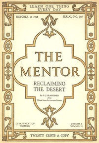
The Mentor: Reclaiming the Desert, Vol. 6, Num. 17, Serial No. 165, October 15, 1918 — Background and Themes

(0 User reviews)   44
In Category - Civil Engineering
Blanchard, C. J. (Clarence John), 1863-1945 Project Gutenberg 2015
Desert reclamation -- Southwest, New; Desert resources development -- Southwest, New; Irrigation -- Southest, New Readers of public-domain and historical texts
Project Gutenberg digital edition en

Edition facts

Words: 12,750
Reading time: 56 min
Text sections: 7
An editorial note on C. J. Blanchard's 1918 Mentor issue, examining how the opening appeal to returning soldiers, the technical descriptions of dams, and the historical contrasts guide a first reading of this desert reclamation text.
Share
Editorial Edition Score 4.6/5

Calculated from edition completeness, EPUB availability, text structure and catalogue metadata. Not a user rating.

Edition quality

Read the Text

ght should now be given to the problem. We should know by the time the war ends, not merely how much arid land can be irrigated, nor how much swamp land reclaimed, nor where the grazing land is and how many cattle it will support, nor how much cut-over land can be cleared, but we should know with definiteness where it is practicable to begin new irrigation projects, what the character of the land is, what the nature of the improvements needed will be, and what the cost will be. We should know also, not in a general way, but with particularity, what definite areas of swamp land can be reclaimed, how they can be drained, what the cost of drainage will be, what crops they will raise. We should have in mind specific areas of grazing lands, with a knowledge of the cattle that are best adapted to them, and the practicability of supporting a family upon them. So, too, with our cut-over lands. We should know what it would cost to pull or “blow-out” stumps and to put the lands into condition for farm homes. We should know what it will cost to buy these lands If they are in private hands. In short, at the conclusion of the war, the United States should be able to say to its returned soldiers: “If you wish to go upon a farm, here are a variety of farms of which you may take your pick, which the Government has prepared against the time of your returning.”

_From a letter to President Wilson from Secretary Lane of the Department of the Interior._

THE MENTOR ASSOCIATION

Established for the Development of Popular Interest in Art, Literature, Science, History, Nature and Travel

THE MENTOR IS PUBLISHED TWICE A MONTH

BY THE MENTOR ASSOCIATION, INC., AT 114 EAST 18TH STREET, NEW YORK, N. Y. SUBSCRIPTION, FOUR DOLLARS A YEAR. FOREIGN POSTAGE 75 CENTS EXTRA. CANADIAN POSTAGE 50 CENTS EXTRA. SINGLE COPIES TWENTY CENTS. PRESIDENT, THOMAS H. BECK; VICE-PRESIDENT, WALTER P. TEN EYCK; SECRETARY, W. D. MOFFAT; TREASURER, J. S. CAMPBELL; ASSISTANT TREASURER AND ASSISTANT SECRETARY, H. A. CROWE.

OCTOBER 15th, 1918 VOLUME 6 NUMBER 17

Entered as second-class matter, March 10, 1918, at the postoffice at New York, N. Y., under the act of March 3, 1879. Copyright, 1918, by The Mentor Association, Inc.

_RECLAIMING THE DESERT_

Irrigation, the artificial application of water to produce crops, is as old as agriculture. Genesis 1,17: “A river went out of Eden to water the garden.” The practice of irrigation is probably coincident with that of the earliest agriculture of record for the reason that the latter was begun in regions of deficient rainfall in the Old World--Egypt, Assyria, Mesopotamia, Persia, India, Ceylon and China. Evidences abound of the existence of important storage and distribution systems constructed previous to 2000 B. C. Even greater antiquity is ascribed to similar work, the remains of which are found in the valley of the Euphrates, and also in China. The ancient aqueducts and subterranean canals of South America, extending for thousands of miles, once supplied great cities and irrigated immense areas. Irrigation on the Continent of North America was old when Rome was in the glory of its youth. Centuries before the venturous Norseman landed upon the bleak and inhospitable shores of New England a large population dwelt in the hot valleys of the Southwest, in New Mexico and Arizona. From the solid rock, with primitive tools of stone, they cut ditches and hewed the blocks for many chambered palaces, which they erected in the desert or on the limestone ledge of deep river canyons. These voiceless ruins, older than the memory of many centuries, tell the story of a thrifty home-loving and semi-cultured people, concerning whose fate history brings us no word. The long lines of their canals, now choked with the wind-swept drift of centuries, give mute and pathetic evidence of the patience and engineering skill of the builders.

Early in the sixteenth century, when Coronada, the first great American explorer, swept up the Rio Grande Valley in Texas and New Mexico, he found a pastoral race dwelling in pueblos and practicing irrigation as had their forefathers, perhaps as far back as in the days of Abraham.

The priests with the aid of their Indian converts extended the practice of irrigation wherever they established the missions, and introduced many varieties of fruits and vegetables from Spain and Italy.

Irrigation by English-speaking people began in America in 1700, and, for fully a century, was confined to use in the cultivation of rice on narrow strips along the coastal rivers of the Carolinas and Georgia.

The first Americans to reclaim extensive areas in the arid region were the Mormons, who, in 1847, settled on the eastern borders of the Great Interior Basin, on the site of Salt Lake City. Under wise leadership and through community effort, numerous canal systems were constructed and extended to thousands of acres of desert lands.

Between 1862 and 1880 many canal systems were constructed in Colorado, though none was important. The success of the Greeley colony, established in 1870 in the northern part of the State, gave considerable impetus to irrigation all over the arid region.

In the last thirty years there has been an awakening to the opportunity that lies in the arid West for the homemaker, and a remarkable transformation has taken place in many parts of this region. Irrigation canals long enough to girdle the globe three times now distribute the normal flow and the stored water of Western streams to millions of acres, which support hundreds of thousands of contented farmers. Cities, populous and great, have sprung up, rural communities, attractive and prosperous, broad vistas of fertile fields and blossoming orchards have replaced the wastes of sand and sage brush.

WRITTEN ESPECIALLY FOR THE MENTOR BY C. J. BLANCHARD ILLUSTRATION FOR THE MENTOR, VOL. 6, No. 17, SERIAL No. 165 COPYRIGHT, 1918, BY THE MENTOR ASSOCIATION, INC.

_RECLAIMING THE DESERT_

Locating and excavating several of the main canals proved almost as difficult and trying as the building of the big dams. This was especially true in the Yakima and Okanogan valleys in Washington, the St. Mary and Flathead in Montana, Uncompahgre and Grand River in Colorado, and the Utah valley, Utah. These canals cling to the edges of deep and precipitous canyons, or hug the steep mountain slopes. Here and there huge aqueducts of reinforced concrete span the chasms. For miles the water is siphoned across broad ravines in iron-banded stave pipe, or flows in tunnels through the cliffs.

The Tieton main canal of the Yakima project, Washington, for a distance of twelve miles is through a very rough country. It is cement lined throughout, and for two miles is in tunnels. For the greater part of its length it hugs the side of the canyon, in places 500 feet above the river. The lining for the canal was molded on the river bank, where water, sand, and gravel were available for concrete making, and the forms were carried to the top of the canyon by tram and cableways. The capacity of the canal is 300 cubic feet per second, and it is now irrigating 40,000 acres. The High line Canal of the Strawberry Valley project swings around the steep slopes of the Spanish Peaks of the Wasatch Range in Utah for several miles. At one point a portion of the water is dropped in pipes to the turbines, where power is developed and distributed to several towns in the valley. At various points along its course the canal is covered with a reinforced concrete roof to prevent injury and filling up from avalanches in the spring.

WRITTEN ESPECIALLY FOR THE MENTOR BY C. J. BLANCHARD ILLUSTRATION FOR THE MENTOR, VOL. 6, No. 17, SERIAL No. 165 COPYRIGHT, 1918, BY THE MENTOR ASSOCIATION, INC.

_RECLAIMING THE DESERT_

_The Gunnison Tunnel_

Notable among the engineering works calling for courage and daring is the Gunnison Tunnel. This great bore, which in a sense changes physical geography, is excavated under the Vernal Mesa in western Colorado. The river portal is in the famous Black Canyon of the Gunnison, a precipitous chasm 3,000 feet deep, and the tunnel extends for nearly six miles, 2,500 feet below the surface of the Mesa. The outlet is in the valley of the Uncompahgre. By means of a low diversion dam, the waters of the Gunnison are turned into the tunnel and transferred to the desert valley of another stream. The early reconnaissance surveys and examinations and the final work of determining the location of the tunnel were attended with unusual dangers. The exploration of the canyon, which up to that time had never been traversed by man, and the careful and detailed preparation of a topographic map of this rugged region called for genuine heroism. In the former task the surveyors risked their lives for many days in the depths of the gorge, and, in the latter, the engineers performed their duties under conditions of great hazard and peril.

The construction forces met and overcame almost every difficulty ever encountered in tunnel excavation. Gas, cave-ins and subterranean springs interposed obstacles throughout the work. At one time a heavy flow of carbon dioxide, or choke damp, forced the workmen to flee for their lives and delayed operations until a ventilating shaft 680 feet deep was sunk. The heavy flows of hot and cold water necessitated the use of large pumps for months at a time. For more than 500 feet the tunnel was driven through a remarkable bed of fossils, consisting of the shells of extinct sea creatures, many of which were of great size. Exposed to the air, disintegration was rapid, and the huge masses of falling rock imperilled the lives of the workmen.

Notwithstanding the extraordinary care of the Government to safeguard the employees, a heavy toll of human lives was taken. The excavation work was projected from four adits, three on the Uncompahgre side and one in the canyon, and crews of drill men and assistants simultaneously began boring into the mountain from both sides. When the last charge of dynamite had been exploded and the tunnel was “holed” through, it was found that the line was true within a fraction of an inch.

Connecting with the outlet of the tunnel is a large cement-lined canal which conveys the water to the valley ten miles below. Here it mingles with the Uncompahgre, and by means of a complex distribution system of canals and laterals, finally reaches the irrigable lands.

The Uncompahgre Valley is one of exceptional scenic beauty, and is blessed with a fertile soil adapted to the growing of a wide variety of products. Its irrigable area is approximately 100,000 acres, more than half of which is now producing two generous harvests.

The discharge of the Uncompahgre River was quite inadequate for the irrigable lands in the valley, which had been brought under the ditches constructed before the passage of the reclamation act, and failure of crops occurred frequently during the low water periods. In addition there were thousands of acres of desert land in the valley doomed to aridity unless the water supply could be supplemented. The Gunnison River, flowing uselessly in its profound canyon on the other side of the range, was drawn upon by means of the tunnel, and an abundance of water is now assured for all the lands included in this project. Agriculture here is exceedingly diversified, and in many sections, is intensive. The products of the soil range include alfalfa, cereals, sugar beets, potatoes, onions, peas, beans, and other vegetables, peaches, pears, and apples. Surrounding the valley are vast areas of fine grazing lands included in national forests, which furnish summer pastures for thousands of cattle and sheep. The rapid settlement of the farm lands has been followed by a corresponding growth of the towns of Montrose, Delta and Olathe.

WRITTEN ESPECIALLY FOR THE MENTOR BY C. J. BLANCHARD ILLUSTRATION FOR THE MENTOR, VOL. 6, No. 17, SERIAL No. 165 COPYRIGHT, 1918, BY THE MENTOR ASSOCIATION, INC.

_RECLAIMING THE DESERT_

First among the imposing structures of the Service in the order of beginning and completion is the Roosevelt Dam, the important engineering feature of the Salt River project in Arizona. Brilliant and daring in its conception, diverse and complicated in its problems, and stupendous in its structural features, the Roosevelt Dam stands today an enduring monument to the creative genius of its designer and builder. The layman will not appreciate the complexity of the problems and the variety of obstacles that were encountered without an understanding of the locality in which the work was carried on. The dam is located in a region which was once regarded as almost inaccessible except to the nomadic Apache, who found a safe refuge here for many years. The nearest railway is 62 miles away. Twenty miles of this distance is across a waterless, parched and forbidding desert. For more than 40 miles the country, gashed and fissured into fantastic forms, a region of stupendous canyons, steep sided mountains, and turbulent streams, presented an almost insuperable barrier to ingress. It is a region of colorful and inspiring scenery, but most unpromising as a site for a large engineering work. The initial step was to build a highway to the dam-site, a task of much difficulty on account of the rough country and the unwillingness of white laborers to do the work. The road was finally completed, largely by utilizing the Apache Indians, many of whom were remnants of Geronimo’s band of marauders. The influence of this experiment in employing Indians has been of lasting benefit to the Red Men of the Southwest, many of whom have continued on similar work for railroads and other corporations. The Roosevelt Road, now familiarly known as the Apache trail, is one of the most spectacular highways in the country, and thousands of tourists go over it each year in automobiles.

The site for the dam was located at the entrance of the profound canyon that Salt River has cut through the mountains. Just above the canyon, Salt River and Tonto Creek converge in a broad, level valley, which is now submerged to a depth of nearly 200 feet, forming one of the largest artificial lakes in the country.

The Roosevelt Dam is of sandstone hewn from the walls of the canyon in which it is built. It is of gravity section, arched up stream, 280 feet high, 168 feet thick at base, and 1,080 feet long on top. At its base it covers an acre of ground. A building 209 feet square and 26 stories high would about cover the space of the dam except that halfway up the sides there would be space for two more structures, each 11 stories high and 885 feet long on top. Owing to the long haul for the railroad the activities of the engineers were varied and numerous. The Government cement mill turned out 600,000 barrels of first-class cement, the saw-mill in the National Forest manufactured all the lumber required to house 2,000 people, and for stores, offices, etc.; a hydro-electric plant furnished power to the contractor on the dam and light for the camp; two farms were operated to supply food for the employés; water works and sewerage systems were installed, and law and order were preserved during four years of construction. The engineer had charge also of a large commissary, a big mess, and superintended a brickyard and cement pipe plant.

During the building of the dam the valley below was the scene of unprecedented activity. A million-dollar diversion dam was constructed across the Salt River to divert the stored water into thousands of miles of canals; power plants, pumping plants, transmission lines, and a thousand and one engineering details were completed in advance of the great day when the turbulent floods of Salt River would be conserved and led to the thirsty lands. On March 18, 1911, former President Roosevelt, in the presence of an assemblage of nearly 1,000 people, formally dedicated the structure which fittingly bears his name. By the simple pressure of an electric button the enormous gates weighing 60,000 pounds were raised and released the pent-up floods for irrigating nearly 200,000 acres of Salt River Valley. The swift passing of years has been marked by marvelous progress in this desert valley. In 1902, when the work was started, the assessed valuation of the country, of which the valley is the larger part, was $5,000,000. In 1916, the taxable property values were $72,000,000. In 1913, the first crop census of the project was taken and showed an irrigated acreage of 159,170, and a gross value of crops of $4,775,000. In 1917, the total acreage watered was 201,600; the gross value of crops was $13,692,000. During the same period the number of farms increased from 3,600 to 4,326. The net cost of the entire project to June 30, 1917, including $3,500,000 for the Roosevelt Dam, was $11,367,000. The annual returns from the land irrigated by it are more than $3,000,000 in excess of this amount. The gross value of crops in 1917 was almost equal to that of New Hampshire and Rhode Island in the census year of 1909. In October of 1917 the Roosevelt Dam, canal system, and power plants were formally transferred to the Water Users’ Association, under whose management the project henceforth will be operated.

WRITTEN ESPECIALLY FOR THE MENTOR BY C. J. BLANCHARD ILLUSTRATION FOR THE MENTOR, VOL. 6, No. 17, SERIAL No. 165 COPYRIGHT, 1918, BY THE MENTOR ASSOCIATION, INC.

_RECLAIMING THE DESERT_

_The Highest Dam in the World_

Arrowrock dam, in Idaho, is probably the most spectacular structure to the credit of the Service. Completed on October 4, 1915, it ranks all other dams in the world in its height, 350 feet above bedrock. It is of rubble concrete, arch gravity type, and contains 585,130 cubic yards of material. It was built by Government forces, and not by contract, and its completion in two years less than the estimated time and at a saving of more than two million dollars in the estimated cost, furnishes a striking example of Federal efficiency and economy. In connection with this important work the engineers built and operated a standard gauge railway 14 miles long, which carried more than 80,000 passengers, and 14,000,000 tons of freight. A unique camp, containing 4,000 people, was established, with sewerage, water works, and electric lights. Schools for the children of employees, a hospital, postal savings bank, churches, and Y. M. C. A., a large general store and commissary, blacksmith and machine shops, sand-grinding and cement-mixing plants, all under the engineer’s direction, gave to the camp the aspect of an enterprising and busy community. It was a camp in which, for four years, there was no night. Throughout the greater part of this period the work proceeded without interruption, night and day, with three eight-hour shifts. Profiting by the experience gained on other large works of the Service, and with labor-saving devices of their own invention, the engineers on Arrowrock worked with extraordinary swiftness and sureness, and established a most enviable record for economy and time. The total cost of the Arrowrock is approximately $5,000,000, and its principal purpose is to conserve the floods of Boise River for the irrigation of 240,000 acres of land embraced in the Boise project.

WRITTEN ESPECIALLY FOR THE MENTOR BY C. J. BLANCHARD ILLUSTRATION FOR THE MENTOR, VOL. 6, No. 17, SERIAL No. 165 COPYRIGHT, 1918, BY THE MENTOR ASSOCIATION, INC.

_RECLAIMING THE DESERT_

_The Romance of the Desert_

A vein of romance runs through every form of human endeavor. No life so sordid, prosaic, or wretched, but has felt sometime its light and gladsome touch. In the desert, romance finds its chief essentials in adventure, courage, daring and self-sacrifice. For more than half a century man has been writing a romance of compelling interest upon the face of the dusty earth. Irrigation, with Midas’ touch, has changed the desert’s frown to smiling vistas of verdure. Its solemn silence has been broken by the voices of countless happy people.

Our national strength is in its citizens, and the place in which the best is bred is in the country. The threat of urban congestion, no longer remote, and the pressure of population, which even now is bearing heavily upon our resources, are unanswerable arguments for increasing and making permanent the nation’s virility, prosperity and growth by creating more country homes.

The issue opens not with a description of arid landscapes but with a direct appeal to returning soldiers: “Land will offer the great and fundamental opportunity.” This framing immediately positions desert reclamation as a postwar national project, not merely an engineering feat. Blanchard, writing as a member of the United States Reclamation Service, specifies three land types—arid, cut-over, and swamp—each requiring a distinct remedy: water, clearing, or drainage. The opening thus establishes a problem-solution structure that a first-time reader can use to anticipate the technical discussions that follow.

A Soldier’s Land, a Nation’s Project

The opening section, “Land and the Home-Coming Soldier,” does not describe any desert. Instead, it argues that returning servicemen will seek outdoor vocations and that the nation must know “with definiteness” where to begin irrigation projects. Blanchard repeats the phrase “we should know” five times, emphasizing practical data over generalities. This rhetorical pattern signals to the reader that the subsequent descriptions of dams and canals are meant to supply that missing knowledge. The tone is urgent and policy-oriented, not lyrical. A first reader should note that the human element—the soldier—is the stated reason for the engineering details that occupy most of the issue.

Concrete and Canyon: Two Dams Described

The middle excerpts describe two dams in markedly different settings. The Elephant Butte dam in New Mexico is called a “monumental structure of masonry” that blocks the Rio Grande canyon. Blanchard gives precise dimensions—318 feet high, crest length 1674 feet—and a striking comparison: the reservoir could “submerge the entire State of Connecticut ten inches deep.” The Shoshone dam in Wyoming, by contrast, required blasting an eight-mile highway through a gorge and removing “enormous boulders eighty feet in thickness.” The language here is more dramatic: laborers were taken to work “by means of baskets” and faced “sudden floods, extreme cold weather.” A first reader can observe how the author varies his technical reporting with human hardship and historical allusion.

Ancient Canals and Modern Machinery

Blanchard repeatedly contrasts past and present. At Elephant Butte, he notes that “irrigation was practiced long before the first written word of our history” and that “a pastoral race dwelt here” centuries before Spanish missionaries. Yet he also records that “modern harvesting machinery is replacing the hand sickle” and “the sulky plow supplants the sharpened stick.” This juxtaposition is not merely decorative; it frames reclamation as the latest phase in a long history of human adaptation. A first-time reader should watch for these historical asides—they appear in nearly every excerpt—and consider how they serve to legitimize the Reclamation Service’s work as a continuation of ancient practice rather than a radical intervention.

Numbers as Narrative

Throughout the excerpts, Blanchard relies on specific figures to convey scale and progress. The Elephant Butte reservoir will hold enough water to cover “2,627,700 acres to the depth of a foot.” The Shoshone dam is “328 feet in height” and will irrigate “150,000 acres.” The Orland project in California includes a detail about “drying almonds.” These numbers are not dry statistics; they are the evidence for the opening claim that “millions of acres of undeveloped lands” can be made available. A first reader might note that the author rarely describes the land itself in sensory terms—no color of soil, no feel of heat—but instead quantifies it. This numerical emphasis shapes the entire issue as a report of feasibility, not a travelogue.

Reading this 1918 issue as a first-time visitor, pay attention to how Blanchard balances three registers: the policy argument for soldier settlement, the engineering marvels of dam construction, and the historical depth of irrigation in the Southwest. The excerpts suggest that the full text will move between these modes without settling into any one. The reader who expects a purely technical manual will find political advocacy; the reader who expects a boosterish pamphlet will find precise measurements and historical context.

There are no reviews for this eBook.

0
0 out of 5 (0 User reviews )

Add a Review

Your Rating *
There are no comments for this eBook.

Reader reflection

How did this book work for you?

Your answers remain private and are stored only in this browser.

Your progress 0 / 10
1

How far have you progressed with this book?

2

Did this book hold your interest?

3

Would you encourage someone else to read it?

4

How much effort did this book require?

Related eBooks